
Losing Jammu & Kashmir in hands of cartographers
Since my childhood, I have been taught that Kashmir is the disputed territory between Pakistan and India. It could be seen by the dotted line on every world map where geographical boundaries among countries are mentioned. It is disputed since 26 October 1947 after a signed controversial document, by the name ‘Instrument of Accession’. According to which, Maharaja Hari Singh, ruler of that time of Jammu & Kashmir, agreed to accede Kashmir to the dominion of India.

However, this fact was unacceptable to Pakistan due to a number of reasons: First, the state had a majority population of Muslims. Second, it not only shares the geographical boundary with Pakistan but also had essential economic linkages with the territory of the Islamic Republic of Pakistan. Due to such reasons, the status of Jammu & Kashmir is still a disputed one. The United Nations and World Community in general also recognizes and respects the stance of Pakistan on Kashmir issue. And consider Kashmir as a disputed territory to date.
But what is astonishing these days, is the removal of dotted Kashmir territory line to the international uninterrupted boundary line within India in world maps.


The Simla Agreement, 1972
The Simla Agreement July 2, 1972, signed by Prime Minister India Gandhi and President of Zulfiqar Ali Bhutto. According to it, the line of control resulting from the cease-fire of December 17, 1971, shall be respected by both sides without any prejudice.
Recent Dilemma
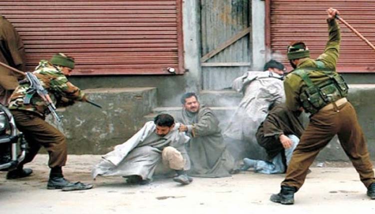
I don’t know exactly when and how it happens. And why Pakistani media hasn’t spoken a single word against it yet. I came to know this a couple of years back and it was really a shock to me. Have we, as Pakistanis accepted our failure to keep Jammu & Kashmir as a part of Pakistan? Is it now a part of India? Have we gifted it to India? What are the political realities and rationale behind it? I am not settled down to the fact that nobody, no journalist, no media person has seen such a map where Jammu & Kashmir is no more a part of disputed territory but India. Why are we so silent? Do our columnists or journalists have such a powerful and magical pen to write on it? Or are we, as a nation become blind who cannot see and react to anything?
According to editorialcalls, which is one body responsible for drawing boundaries,

It is indeed a time to ponder! Today is 5th February. You might be enjoying Government holiday because of Kashmir Day. I beg you to please raise this matter to the possible highest authorities nearby you. We must do something together. It is a need of an hour that cartographers must be reminded about that UN resolution. If we let Jammu & Kashmir be a part of India, I doubt that Allah forbids that day is not so far when Indians will take over Azad Kashmir too, according to same grounds of Instrument of Accession. As editorialcalls state this about Azad Kashmir:

Also Read Where is Jinnah Ka Pakistan?